Much larger challenges have been solved around the world. Although it might seem that the problem is complex, we can come together as a society to craft a feasible solution. We plan to leverage the expertise of many technical experts with a connection to Nepal to build a framework that elected government officials, and civil servants can rely on.
In this section, we provide some examples from cities around the world which are bigger than Kathmandu as an inspiration for how similar challenges were solved.
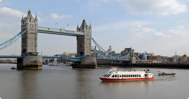
Today, the River Thames is thought to be among the cleanest waterways flowing through a big city. But this was not always the case — It was declared biologically dead in 1957, when surveys found that aquatic life could not survive in its waters.

The First Industrial Revolution (1760-1840) caused a boom in London’s population, which crossed 2.5 million by the middle of the 19th century. The city grew cramped, with the population density rising to 8,446 people per square kilometer. And as the number of industries and people moving to the metropolis grew, so did the factory and household waste discharged directly into the waterway. But with the Thames serving as the main drinking water supply for people in the metropolis, it soon began to be blamed for the frequent outbreaks of cholera.
Things took a worse turn in 1858, when summer brought with it an overwhelming stench that pervaded the city and prompted the nickname the ‘Great Stink’. Lawmakers were prompted to action, and eventually, an underground network of brick sewers was built in the city. Unfortunately, the sewers were damaged during World War II. With human and industrial waste again being dumped into the Thames, its waters become contaminated and it lost the ability to support aquatic life.
Finally, the city of London took note of the situation in the 1960s. A bill to reduce water pollution was passed in 1961, and raw sewage that flowed into the river began to be processed in 1976. In a bid to raise the levels of Dissolved Oxygen, two oxygenators were set up in the waters and together, these “bubblers” are credited with bringing much of the biodiversity back to the waters of the Thames. It might have been unthinkable in the 1960s, but today, the Thames supports over 100 different species of fish.
Even today, the UK government is making efforts to consistently upgrade its sewage infrastructure keeping in mind the growing population. With the 2021 Census recording a population of 8.9 million people in London, the Thames Tideway Tunnel is designed to ease the pressure on the city’s present sewage system. The pipe is 25 kilometers long, with a depth of 66 meters and a diameter of 7 meters. It will run underneath the city, along the route of the Thames, and prevent overflows from the Victorian-era sewers into the river. The tunnel has been built at a cost of £5 billion (over $6 billion).
When it rains in London, the drains overflow with rainwater and sewage. This overflow spills into the Thames, contaminating its water. But thanks to the Thames Tideway Tunnel, the overflow will be intercepted from the sewers and subsequently diverted to a massive tunnel. With the capacity to hold 1.6 million cubic meters of liquid, the “super sewer” will store wastewater and excess rainwater until it can be transported to a sewage treatment plant. This is expected to drastically reduce the amount of untreated sewage that gets released into the Thames every year.
In many ways, the story of the Thames and the Bagmati River is similar. The Thames was declared biologically dead, and its water quality deteriorated around the same time London’s population crossed 2.5 million.
Untreated sewage and industrial waste finding their way into the Thames culminated in the summer of 1858, when the stench emanating from the river became so bad that it actually drove Londoners out of the city. Unfortunately, here we find another parallel to the Bagmati — domestic and industrial waste is dumped directly into its waters, causing a foul odor to arise during the drier months. However, these comparisons also give hope. Today, the Thames has bounced back from being biologically dead. Despite London having a high population density of 5,640 individuals per square kilometer, the ecosystem of the Thames is thriving, and it is among the cleanest rivers to run through a city — especially one as urbanized as London.
It is pertinent to note that Nepal’s Bagmati River already has an advantage: London is a dry city, receiving just 23 inches of rain throughout the year — less than half that of Kathmandu Valley. With rainwater serving as a means to flush dirty water downriver, the Bagmati already has an added advantage.
The Yongding River river originates in the Shanxi province, north of the Great Wall, and runs for 650 kilometers before joining the Bo Hai Sea. Located at a latitude of 39.1623° North and longitude of 117.1762° East, it flows through Shanxi, Inner Mongolia, Hebei, Beijing, and Tianjin. It covers a basin area of roughly 47,016 square kilometers.
Interestingly, it has not always had this name — There was a time when it was nicknamed Wuding He (meaning ‘river that does not have a fixed course’) because it changed its course frequently, flooded often, and had an irregular flow. To reduce its flooding, hydraulic engineering work was completed in the late 1600s. Following this, it began to be called Yongding He or ‘fixed river’. It was also nicknamed the “mother river” of Beijing — At a length of roughly 170 kilometers in the capital city, it is the largest river to flow there.
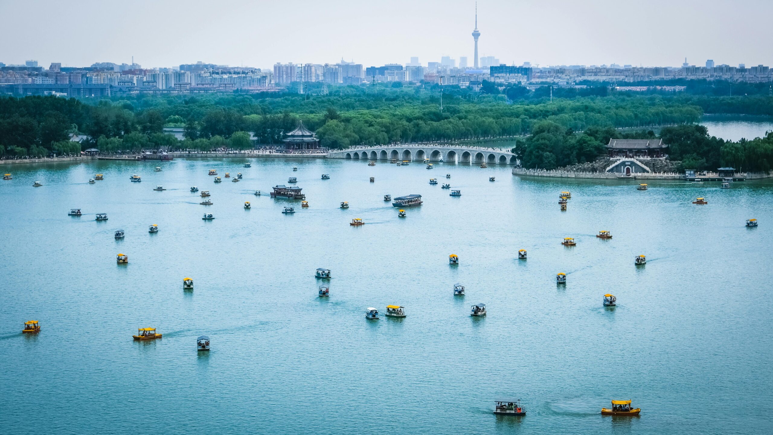
Flood mitigation measures continued into the 20th century. Reservoirs were constructed, but these had an adverse effect: The volume of water flowing through the channel began to fall, and parts of the river eventually dried up. When residents started tapping into underground water sources, groundwater levels near the river fell, disrupting the link between underground water and surface water. This, in turn, exacerbated the drying of the riverbed downstream. The Yongding had fallen on hard times.
Interestingly, it has not always had this name — There was a time when it was nicknamed Wuding He (meaning ‘river that does not have a fixed course’) because it changed its course frequently, flooded often, and had an irregular flow. To reduce its flooding, hydraulic engineering work was completed in the late 1600s. Following this, it began to be called Yongding He or ‘fixed river’. It was also nicknamed the “mother river” of Beijing — At a length of roughly 170 kilometers in the capital city, it is the largest river to flow there.
Flood mitigation measures continued into the 20th century. Reservoirs were constructed, but these had an adverse effect: The volume of water flowing through the channel began to fall, and parts of the river eventually dried up. When residents started tapping into underground water sources, groundwater levels near the river fell, disrupting the link between underground water and surface water. This, in turn, exacerbated the drying of the riverbed downstream. The Yongding had fallen on hard times.
During the latter half of the 20th century, the setting up of factories and power plants near the riverbed polluted the soil nearby, which in turn, adversely affected the river’s water quality. Furthermore, the rapidly growing population of Beijing meant that the pressure on water sources rose while the run-off from the Yongding lessened. By 1996, the population of Beijing had exceeded 12.5 million, making it one of the most populous capital cities in the world. So many people meant there was a high demand for limited resources — As a result, the groundwater table deepened in some areas in the decades preceding 2010. To add to this, annual precipitation failed to be of much help: Beijing receives just 22 inches of rainfall in a year on average.
In 2009, roughly three decades after parts of the Yongding River had dried up, the government approved the Yongding River Green Ecological Corridor to increase groundwater recharge and restore biodiversity. As part of this 16 billion yuan (about $2.2 billion) ecological project, authorities created lakes and wetlands to reduce pressure on the river. Furthermore, water management structures, including reservoirs, were set up in a bid to prevent flooding, while trees were planted to reduce soil erosion. In their study, Spatiotemporal Changes of Riverbed and Surrounding Environment in Yongding River (Beijing section) in the Past 40 Years, Tri Dev Acharya, He Huang, and Ran Pang note that water bodies in the Yongding River basin in Beijing declined considerably between 1989 and 1999. Thanks to increased awareness and government action, they rose by 92% between 2010 and 2018.
A significant step has been the transfer of water from Wanjiazhai, a major reservoir on the Yellow River. Since 2017, more than 1.34 billion cubic meters of replenished water has made its way to the Yongding River. These efforts have definitely borne fruit: 2023 was the first year in almost three decades when water in the river flowed throughout the year.
Spread across 4,567 square kilometers, Beijing is now home to roughly 22 million people. The green corridor is expected to enhance the quality of life for the residents of the capital city. Work on the corridor is expected to be completed in 2025. The project is aimed at benefitting the riverbank as a whole, from enriching the natural river environment and planting trees and shrubs near the river basin to constructing a riverside walkway for people to enjoy.
The blue-green corridor, a play at the color ‘blue’ for water and ‘green’ for vegetation, also includes streams, lakes, and public parks. In addition to improving biodiversity and access to water, the project aims to attract tourists to the city.
The Sumida River holds great cultural significance in Japan. From woodblock prints to haiku poems, this river has been immortalized by the artists and historians of the nation. Despite being only 27 kilometers long, the Sumida is one of the main rivers servicing the capital city. It originates from the Arakawa River, flows through the center of the city and empties itself into Tokyo Bay.
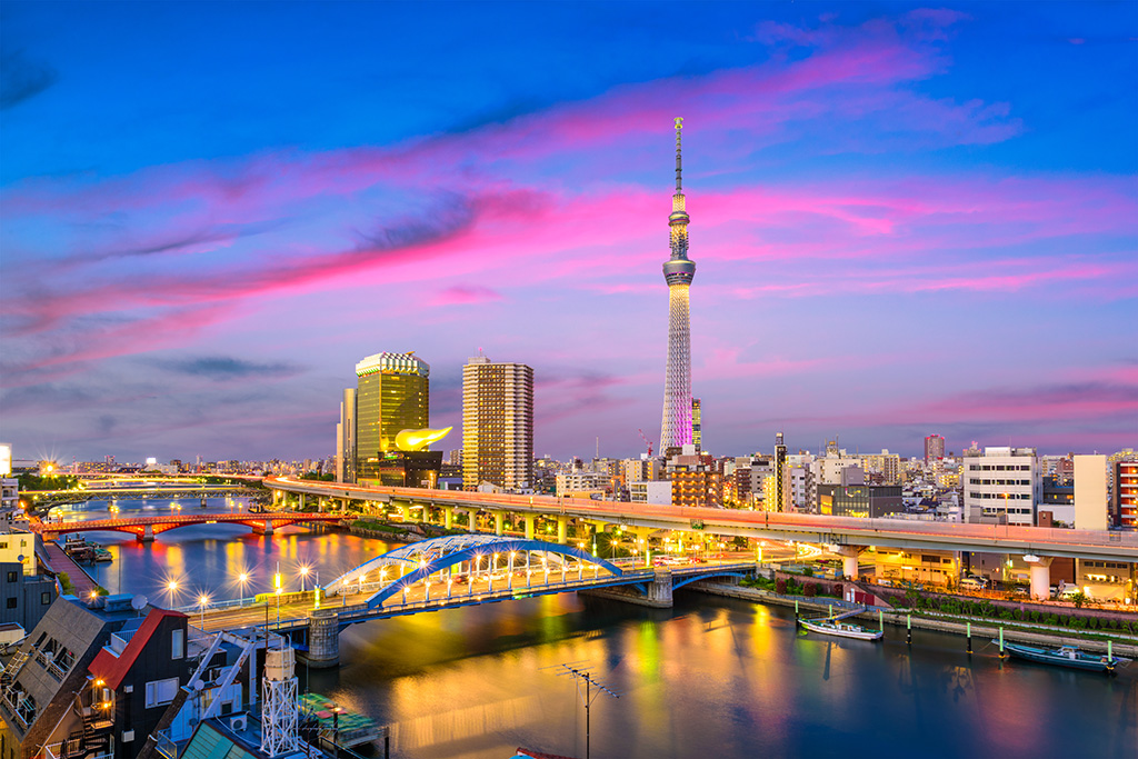
In Tokyo, the Sumida serves as a recreational spot and transportation route. For the 37 million people who call the Tokyo metropolitan area home, traffic during rush hour can be quite an inconvenience. Thankfully, access to the water bus service on the Sumida eases some of these issues.
In Tokyo, the Sumida serves as a recreational spot and transportation route. For the 37 million people who call the Tokyo metropolitan area home, traffic during rush hour can be quite an inconvenience. Thankfully, access to the water bus service on the Sumida eases some of these issues.
Interestingly, Tokyo’s Sumida and London’s Thames share a few similarities. Both rivers witnessed a rise in water pollution following the Second World War. And much like the Thames, which had suffered as a result of rapid population growth fueled by industrialization, the water quality of the Sumida declined considerably during the mid-20th century. Notably, this was when post-war industrialization and economic activity really took off in Japan. By the 1950s, the Sumida had started emitting an unpleasant odor and fish were no longer able to survive in its waters. The water quality only worsened, and by the early 1960s, BOD levels in the river had touched 63 mg/L — nearly 13 times the safe limit for water bodies.
Interestingly, Tokyo’s Sumida and London’s Thames share a few similarities. Both rivers witnessed a rise in water pollution following the Second World War. And much like the Thames, which had suffered as a result of rapid population growth fueled by industrialization, the water quality of the Sumida declined considerably during the mid-20th century. Notably, this was when post-war industrialization and economic activity really took off in Japan. By the 1950s, the Sumida had started emitting an unpleasant odor and fish were no longer able to survive in its waters. The water quality only worsened, and by the early 1960s, BOD levels in the river had touched 63 mg/L — nearly 13 times the safe limit for water bodies.
Thankfully, the Summer Olympics were not far behind. Tokyo’s infrastructure underwent significant improvement ahead of the 1964 Olympics, with many new domestic lines being added to the municipal sewage network. But this was not all: New methods to clean wastewater were introduced, and in 1966, new sewage treatment facilities opened up. The Tokyo Metropolitan Government (TMG) also took matters into its own hands, introducing anti-pollution measures that were stricter than countrywide standards. These measures included the regulation of domestic and industrial wastewater discharge, alongside factory inspections and training exercises.
However, additional measures were necessary. The sludge accumulated on the riverbed began to be removed via dredging, and this practice remains ongoing. Furthermore, the Sumida’s dirty water had to be diluted, for which water from a cleaner river was needed. Therefore, authorities built a man-made channel to connect the Sumida and the Tone. This allowed fresh water to flow into the Sumida, diluting its polluted waters. By the late 1970s, the river was no longer biologically dead — aquatic life began to be seen in its waters.
Today, the Sumida is more than just a transportation route. It is home to several popular tourist attractions and a venue for festivals.
While the restoration methods may have been different for all three rivers, the Thames, Yongding, and Sumida all suffered a similar fate at the hands of rapid industrialization and economic growth. Their respective cleanups are proof that even the most polluted of waterways can be restored to their original, pristine glory in a matter of a few years. Whether it is a multibillion-dollar project with international funding or a smaller one at a local level, it has the potential to change the river — and the lives of the people who live near it.
Much larger challenges have been solved around the world. Although it might seem that the problem is complex, we can come together as a society to craft a feasible solution. We plan to leverage the expertise of many technical experts with a connection to Nepal to build a framework that elected government officials, and civil servants can rely on.
In this section, we provide some examples from cities around the world which are bigger than Kathmandu as an inspiration for how similar challenges were solved.
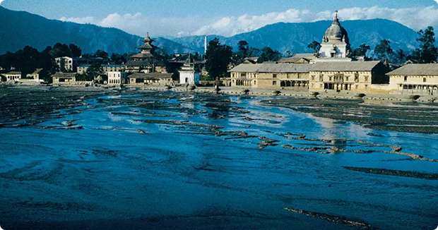
Thames River Sumida River Yongding River
The River Thames (London) is thought to be among the cleanest waterways flowing through a big city. But this was not always the case — It was declared biologically dead in 1957, when surveys found that aquatic life could not survive in its waters.
